Whether it’s a student studying geography, a traveler exploring national parks, or a community relying on clean water, rivers influence daily life in ways many people rarely notice. Understanding these waterways helps us appreciate how deeply they are connected to American history and development.
This comprehensive guide explores the biggest rivers in the USA, providing critical geographic data, historical context, and the modern economic value of these massive waterways.
What Is the Longest River in the USA?
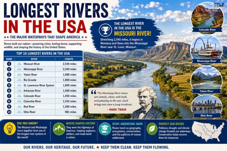
If you are looking for the absolute longest river in the United States, that title belongs to the Missouri River. Stretching an impressive 2,540 miles (4,088 km), this massive waterway
It begins in Montana and flows into the Mississippi River near St. Louis, Missouri. According to the U.S. Geological Survey (USGS), it is longer than the Mississippi River by roughly 200 miles.
Missouri River vs Mississippi River: Which Is Longer?
Many people assume the Mississippi River is the longest river in the United States because of its immense historical and cultural importance. However, according to the U.S. Geological Survey, the Missouri River is actually longer, measuring approximately 2,540 miles compared to the Mississippi’s 2,340 miles. Together, these two major rivers in the United States combine to form the longest river system in North America, acting as the primary drainage system for the entire central portion of the country.
Why Are Rivers Important to the United States?
From supplying drinking water to helping farmers grow crops and supporting wildlife, rivers remain essential to everyday life across the United States. Many major cities developed along these American rivers because they served as natural trade routes long before modern highways existed. As author Mark Twain famously noted about the country’s main waterway:
“The Mississippi River towns are comely, clean, well-built, and pleasing to the eye. Each brings into view a long riverfront.”
Top 10 Longest Rivers in the USA
River lengths are based primarily on data from the U.S. Geological Survey (USGS). Minor variations may occur between sources because river lengths can change depending on measurement methods and tributary classifications.
| Rank | River | Length |
| 1 | Missouri River | 2,540 miles |
| 2 | Mississippi River | 2,340 miles |
| 3 | Yukon River | 1,980 miles |
| 4 | Rio Grande | 1,900 miles |
| 5 | St. Lawrence River System | 1,900 miles |
| 6 | Arkansas River | 1,469 miles |
| 7 | Colorado River | 1,450 miles |
| 8 | Columbia River | 1,243 miles |
| 9 | Red River | 1,360 miles |
| 10 | Ohio River | 981 miles |
Detailed Guide to the Longest Rivers in America
1. Missouri River
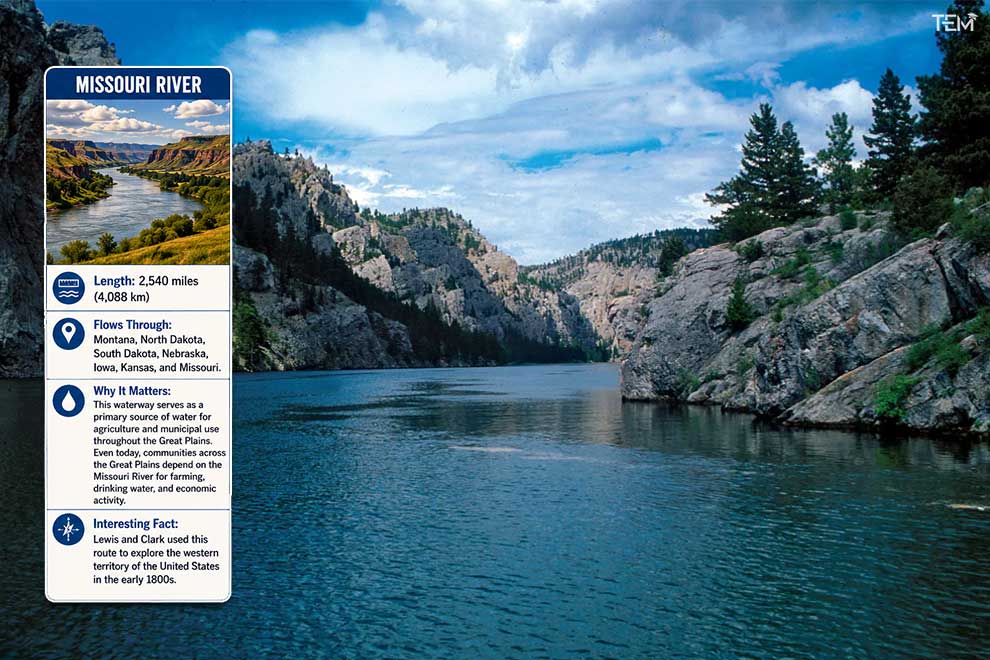
- Length: 2,540 miles (4,088 km)
- Flows Through: Montana, North Dakota, South Dakota, Nebraska, Iowa, Kansas, and Missouri.
- Why It Matters: This waterway serves as a primary source of water for agriculture and municipal use throughout the Great Plains. Even today, communities across the Great Plains depend on the Missouri River for farming, drinking water, and economic activity.
- Interesting Fact: Lewis and Clark used this route to explore the western territory of the United States in the early 1800s.
2. Mississippi River
- Length: 2,340 miles (3,766 km)
- Flows Through: Minnesota, Wisconsin, Iowa, Illinois, Missouri, Kentucky, Tennessee, Arkansas, Mississippi, and Louisiana.
- Why It Matters: The Mississippi River is one of the most important transportation corridors in North America, supporting commercial shipping, agriculture, and wildlife migration. Every year, millions of birds follow this route during seasonal migrations, making the river one of the most important wildlife corridors in North America.
- Interesting Fact: The Mississippi Delta is widely recognized as the birthplace of blues music and has played a major role in American cultural history.
3. Yukon River
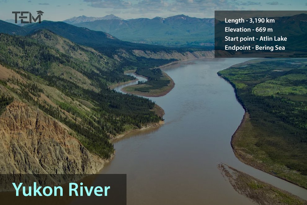
- Length: 1,980 miles (3,185 km)
- Flows Through: Alaska (and the Yukon territory in Canada).
- Why It Matters: It serves as a vital resource for local indigenous communities and supports one of the longest salmon migration runs in the world.
- Interesting Fact: The river was a major transportation route during the Klondike Gold Rush of 1896.
Did You Know? If the Missouri and Mississippi rivers are measured together as one river system, they form one of the longest river networks in the world.
4. Rio Grande
- Length: 1,900 miles (3,057 km)
- Flows Through: Colorado, New Mexico, and Texas.
- Why It Matters: It acts as a critical natural political border between the United States and Mexico while providing essential irrigation water for arid agricultural regions.
- Interesting Fact: Because of heavy water diversion for farming and cities, certain segments of the river occasionally run completely dry before reaching the Gulf of Mexico.
5. St. Lawrence River System
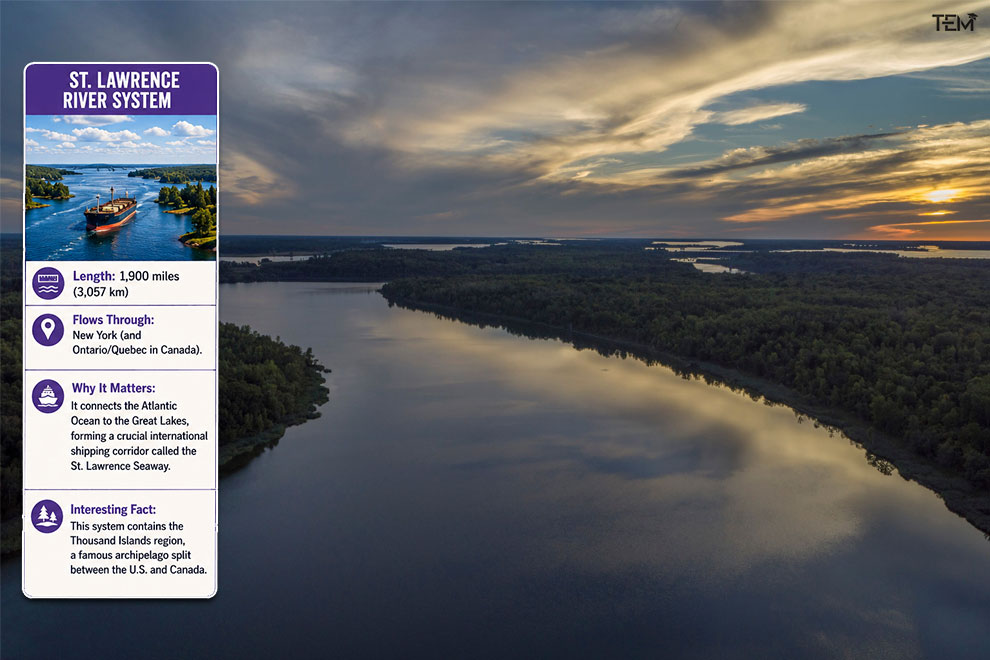
- Length: 1,900 miles (3,057 km)
- Flows Through: New York (and Ontario/Quebec in Canada).
- Why It Matters: It connects the Atlantic Ocean to the Great Lakes, forming a crucial international shipping corridor called the St. Lawrence Seaway.
- Interesting Fact: This system contains the Thousand Islands region, a famous archipelago split between the U.S. and Canada.
6. Arkansas River
- Length: 1,469 miles (2,364 km)
- Flows Through: Colorado, Kansas, Oklahoma, and Arkansas.
- Why It Matters: It provides immense water supplies for farmers and municipal networks across the American West and South.
- Interesting Fact: The river starts as a steep mountain stream in the Rocky Mountains before transitioning into a wide, slow-moving river in the plains.
Did You Know? Despite its name, the Arkansas River starts high up in the Rocky Mountains near Leadville, Colorado, meaning its initial waters come entirely from mountain snowmelt before reaching the plains.
7. Colorado River
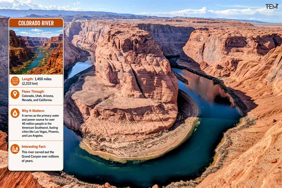
- Length: 1,450 miles (2,333 km)
- Flows Through: Colorado, Utah, Arizona, Nevada, and California.
- Why It Matters: It serves as the primary water and power source for over 40 million people in the American Southwest, fueling cities like Las Vegas, Phoenix, and Los Angeles.
- Interesting Fact: This river carved out the Grand Canyon over millions of years.
8. Columbia River
- Length: 1,243 miles (2,000.7 km)
- Flows Through: Washington and Oregon.
- Why It Matters: It is the largest generator of hydroelectric power in North America, producing vast amounts of clean energy for the Pacific Northwest.
- Interesting Fact: The Columbia River basin is home to the Grand Coulee Dam, one of the largest concrete structures in the world.
9. Red River
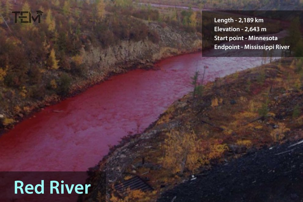
- Length: 1,360 miles (2,188.7 km)
- Flows Through: Texas, Oklahoma, Arkansas, and Louisiana.
- Why It Matters: It supports rich agricultural lands and acts as a major tributary to the Atchafalaya and Mississippi rivers.
- Interesting Fact: The river gets its name from the red clay soil that colors its water during floods.
Did You Know? The Ohio River is actually the largest tributary by volume to the Mississippi River, supplying even more water to the main channel than the much longer Missouri River does.
10. Ohio River
- Length: 981 miles (1,579 km)
- Flows Through: Pennsylvania, Ohio, West Virginia, Kentucky, Indiana, and Illinois.
- Why It Matters: It carries more commercial freight traffic by weight than almost any other waterway in the country, supporting the industrial heartland.
- Interesting Fact: It historically served as a boundary line between free states and slave states before the Civil War.
How River Length Is Measured
Determining the precise length of rivers in the USA is not always straightforward. Scientists must decide exactly where a river begins, which tributaries to include, and how to account for natural changes in river channels. Over time, flooding and erosion alter the bends of a river, shortening or lengthening the main channel. As a result, river length estimates can vary slightly across different academic and government sources.
How Rivers Shaped American History
Long before railways and highways existed, rivers served as America’s main transportation routes. Early settlements, trade centers, and major cities often developed near waterways because they provided access to food, transportation, and commerce. Rivers played a critical role in westward expansion, industrial growth, and the movement of goods throughout the country.
What Students Can Learn From America’s Rivers
Studying river systems in the United States helps students understand geography, ecosystems, environmental conservation, and human settlement patterns. Rivers show how geography can shape where people live, how businesses grow, and how ecosystems thrive.
For example, students can analyze how the development of early American cities relied almost entirely on proximity to navigable waterways.
Challenges Facing Major U.S. Rivers
Many of the longest waterways in America face serious environmental challenges today. These threats include pollution, habitat loss, invasive species, severe drought, and climate change. Heavy agricultural runoff often introduces chemicals into the water, while dams can disrupt fish migration patterns. Conservation programs across the country actively aim to protect these vital river systems in the United States for future generations.
Conclusion
America’s longest rivers are far more than simple geographic landmarks. They support vast ecosystems, power regional economies, influence local cultures, and provide essential resources to millions of citizens. While the Missouri River holds the official title of the longest river in the USA, every waterway on this list has helped shape the country’s history and continues to play a vital role today. Protecting these resources ensures that our agricultural, economic, and natural systems remain strong for centuries to come.
FAQs
- Why is the Missouri River considered the longest river in the United States?
The Missouri River measures approximately 2,540 miles, making it around 200 miles longer than the Mississippi River according to USGS data.
- Which river flows through the most U.S. states?
The Mississippi River system touches or influences more states than any other major U.S. river, directly flowing through 10 distinct states.
- Why are rivers important to the United States?
Rivers are important to the United States because they provide freshwater, support agriculture, enable industrial transportation, generate energy, and sustain wildlife habitats.
- How many major rivers are there in the United States?
The United States has more than 250,000 rivers and millions of miles of waterways.